
![[Athena]](gifs/athena.gif)
![[Curriculum]](gifs/curric.gif)
![[Earth Resources]](gifs/land.gif)
| Cartography - |
| the Art of Making Maps, the Science of Where You Are |
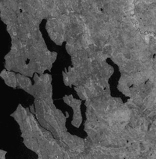
| This image of the Seattle area was taken by the Multispectral Scanner (MSS) on Landsat. The satellite orbits the Earth at about 700 km altitude. This is a single channel image: the brightness of points in the image shows how much light of a specific wavelength (color) the satellite sensor image recorded. The MSS sensor has a spatial resolution of about 75 meters. This means that, usually, you can't make out objects which are smaller than about 75 meters. |  |
 |
 |
|
|
View a larger image (over 1Mb!). |
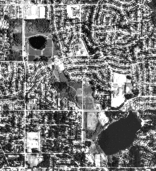
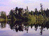
This is an aerial survey photo of the Lake Hills Greenbelt area in Bellevue. The photo is taken from an airplane flying at 20,000 ft. The resolution in this photograph is about 1 meter. The lake in the upper left is Larsen Lake; Phantom Lake is in the lower right. (You can see both these lakes in the Landsat image at the top of this page: they are north of I-90 and west of Lake Sammamish.)  |
|
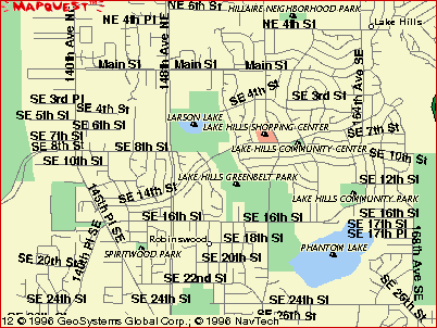
This map of the Bellevue area includes the Greenbelt shown in the
picture above. |
 |
| Suppose you want to get an image with 20 m resolution. What is a good altitude? If you were at 500 km instead of 700 km, what kind of resolution can you expect? These questions might seem impossible to answer, but you can make some simplifying assumptions to get a reasonable approximation. | |
|
This is not an exact calculation, but often calculations like this help
scientists and engineers figure out if a job is going to be easy or
difficult.
For example, knowing you can get 1 m resolution with a good
imaging system at 20,000 ft tells you that you need an extremely
good imaging system to get 1 m resolution at 700 km.
The basic assumptions you used for your approximation are: 1. The imaging systems on Landsat and the aerial survey missions are similar. (This assumption lets you plot the aerial survey data and the Landsat data on the same graph.) 2. "Resolution" refers to the width of an object, not its area. (This assumption lets you draw a straight line between the points.) |
Zoom back up to Puget Sound Maps.
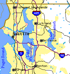
Map of Seattle and vicinity from the Tiger Map Service of the US Census Bureau.
Detailed MapQuest! map of the Lake Hills Greenbelt area is copyright 1996 GeoSystems Global Corporation, Inc.

![[Feedback]](gifs/feedback.gif) Tell us what you think about this page.
Tell us what you think about this page.