
![[Athena]](gifs/athena.gif)
![[Curriculum]](gifs/curric.gif)
![[Earth Resources]](gifs/land.gif)
| Cartography - |
| the Art of Making Maps, the Science of Where You Are |
 This false color image uses data from the Landsat satellite to show land cover. Information from different color sensors on the satellite is processed to show forests in green and deserts in red. The light blue regions are the highest mountains in Washington. Note: this is a different color scheme than the AVHRR image you saw in "Maps of North America and the USA." |
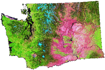 Large Landsat image (499kb). |
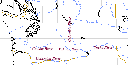 |
In this outline map of Washington, the borders with Canada (north),
Idaho (east), and Oregon (south) are shown in brown.
Major rivers are drawn in blue. |
|
The habitat maps in the following activities are from the Washington State Gap Project. The goal of this project is to identify species and their habitat and recognize potential loss of habitat that could endanger them. Rather than hike over the whole state, Gap Project personnel went to a very large number of places in the state and counted the number of animals they found. They then used the Landsat map to determine similar habitat and combined this data with the field work to generate the maps. |
|
1. Compare these two habitat maps to the Landsat image at the top of this page. Consider the type of environment toads and snakes like and match each map to the species it represents. (Hint: toads are amphibians, which means that they spend part of their time on land and part of the time in water.) 2. Explain your choice. 3. Is the Western Toad likely to be food for the Western Rattlesnake? Why or why not? |
Map A: Toad or Snake?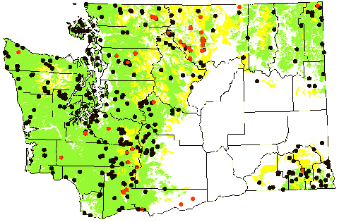 |
Map B: Snake or Toad?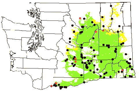 |
|
1. Compare these two habitat maps. Consider the types of food eaten by Bald Eagles and House Sparrows and match each map to the species it represents. (Hint: Bald Eagles can sometimes be seen along rivers diving for salmon.) 2. Explain your choice. 3. Neither bird seems to live in the highest mountain ranges (compare the habitat maps to the Landsat image at the top of the page). Why do you think that is? |
Map A: Eagle or Sparrow? |
Map B: Sparrow or Eagle?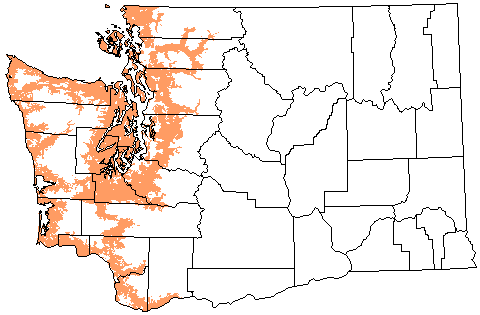 |
Zoom down to Puget Sound Maps.
Zoom back up to Maps of North America and the USA.
Line Map - Xerox PARC Map Viewer.
![[Feedback]](gifs/feedback.gif) Tell us what you think about this page.
Tell us what you think about this page.