![[Athena]](gifs/athena.gif)
![[Curriculum]](gifs/curric.gif)
![[Earth Resources]](gifs/land.gif)
| Cartography - |
| the Art of Making Maps, the Science of Where You Are |
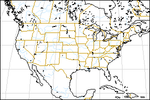
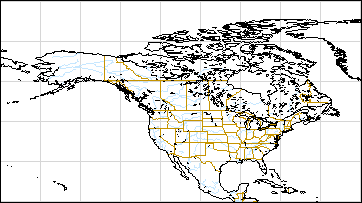
 We've zoomed down to view just North America in the GOES-6 image. On a map of the corresponding area, we can put in more details since we are showing less of the Earth. In this map, rivers are blue; national borders, state borders (USA) and province borders (Canada) are brown. Using the elliptical projection for the map produces a map that looks very much like the image. As you can see, the horizontal, East-West lines of latitude are parallel, but the North-South lines of longitude curve to meet at the poles. This can make it tricky to determine the directions. For example, on this map, "north" depends on position. At the bottom left of the map, north is up and a little bit to the right. At the bottom right of the map, north is up and a little bit to the left. |
|
|
Answer the following questions:
|
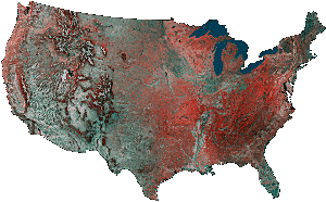
| This map of the continental United States uses color to show vegetation and shading to show topography - mountains and valleys. The vegetation data comes from processing data from special cameras on the AVHRR (Advanced Very High Resolution Radiometer) satellite. Vegetation reflects the green part of sunlight, as well as infrared, but does not reflect much of the other wavelengths. Water, soil, rock, roads, and buildings reflect sunlight differently. Scientists combine the amounts of reflected green, red, and infrared light to map vegetation. A map of land elevation is then added to show the topography. In this false color image, the amount of red (not green!) indicates what and how much is growing at a location. | |
 |
|
| Match Images to Locations | |
|---|---|
| Small Image | Location Description |
1.  |
A. The Great Salt Lake and the Great Salt Lake Desert in Utah |
2.  |
B. New York City (on the Atlantic Coast) |
3.  |
C. Mojave Desert in southern California |
4.  |
D. Chicago, Illinois (on the southwest shore of Lake Michigan) |
5.  |
E. The Mississippi River Delta in Louisiana (Can you also spot New Orleans and the surrounding communities?) |
6.  |
F. Tall peaks in the Rocky Mountains (Hints: what is the treeline? what would snow look like on a vegetation map?) |
7.  |
G. Cascade Range in Oregon and northern California (Look for the rain shadow effect: slopes are drier away from the direction of the prevailing weather path.) |
8.  |
H. The Florida Everglades (Can you also see Miami, Fort Lauderdale and the nearby communities?) |
Zoom down to Maps of Washington State.
Zoom back up to World Maps.
Topographic map - Los Alamos National Laboratory presents an image derived from AVHRR data transmitted by NOAA's GOES-8 & 9 satellites.
![[Feedback]](gifs/feedback.gif) Tell us what you think about this page.
Tell us what you think about this page.